Angel Lake, Wells NV 


The town of Wells was a great spot to camp for two nights, in order to have a “catch-up” day and get a hike in to Angel Lake.
————–
Not much to the town itself though. The town was named Humboldt Wells because it lies at the headwaters of the Humboldt River. Even before its founding in 1869, this northeastern Nevada mainstay was catering to travelers. First with the pioneers of the California Trail, then railroad builders and later passengers who headed west on the steel rails, found Wells an ideal place to stretch their legs or overnight it. Some stayed on, establishing ranches and mercantile, building churches and schools.
——————
Angel Lake was beautiful. To get there, it’s a 12 mile ride out into a lone highway that’s one way in and out. Eventually, you get close enough to the mountain to see the numerous switchbacks to get up to around 10,000 feet at the top!  There are two boondocking campgrounds; Angel Creek is about two-thirds up and is nestled around pretty aspen trees and lots of free range cattle. It has a great view of the sagebrush and grass valley below. The Angel Lake Campground is up at the top of the mountain range and right next to the Lake. Either campground would be ideal for Class B weekenders. We drove up there relatively late in the day so long hikes were out. But the lake is stocked with fish and is popular among fisherman. It’s a good place for families too to hang out for the day; some brought big inflatables for kids to perch off of, and the unique high walls around the lake offered fun echoes of kids hollering and one dog in particular had fun barking with himself. Since lengthy hikes were out, we did stroll around the rim for a bit, and took our time cruising back down the mountain to soak in the vast scenic vistas below in 180 degree plus panoramas.
——————


Lamoille Canyon, Elko NV 


The town of Elko was a great spot to camp for two nights, in order to hike in the Lamoille Canyon. Not much to the town itself though.
——————
The Ruby Mountains are Nevada’s wettest, and therefore most verdant mountain range. The Lamoille Canyon scenic byway is a 12 mile one way in, one way out highway that cuts through some Alp-like scenery. It was so beautiful and a much different atmosphere than the surrounding area’s sparser desert. There are 10 peaks above 10,000 feet and dozens of alpine lakes. Ruby Dome is the highest peak at 11,388 feet! Bighorn sheep are apparently in abundance out here, but we unfortunately didn’t see one (nor much of any other wildlife except for raptors in the air). 
At the very end of the highway, you have several options for hiking trails, including a 40-mile Ruby Crest National Scenic Trail. We didn’t do that one, go figure.  What we did opt for was to take the Lamoille Lake trail, a mere 2 miles long. However, it wasn’t quite so easy as we had thought. The quick elevation gain (about 1500 feet I think) was noticeable to both of us. But it was so well worth it; we ended up at the Lake (after passing Dollar lake too) and my trusty Altitude app revealed we were at an elevation of 9750 feet!.
——————


Cowboy Corridor


Strange and wacky Nevada. Pictured above is Thunder Mountain. This attraction was a side pit stop on the I-80 Cowboy Corridor from Reno to Winnemucca. Thunder Mountain Monument looks as if the contents of a landfill popped to the surface and fell into a pattern over five acres that is part sculpture garden, part backyard fort, part Death Valley theme park. Interesting to say the least. Turns out it’s a deeper story than the apparent junk tells. Read more at
 

http://www.thundermountainmonument.com/

——————
Day trip from Winnemucca:
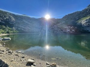
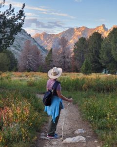
* Water Canyon Recreation Area – managed by BLM, this place seemed so far out of town, yet it was only a 10 minute drive. Too bad we don’t have a Jeep. We ask a lot of our compact car Lois, and she’s done us well, but Nevada exploration truly requires a 4-wheel vehicle. Fortunately, the mile or so of dirt road to get there was in good condition, and we were treated to some spectacular views.
* Paradise Valley – 40 miles north of Winnemucca, the Valley town was reachable by a paved road. A bit unsettling though, as numerous “Call 911 for Medical Services” signs were posted every 5 miles or so. Cell service was up and available, and with a case of bottled water in the back seat we felt as if we could take on a dose of risky traveling. The small town of Paradise Valley nestled in a large grove of tall Cottonwood trees, and  is almost a ghost town with so many old abandoned buildings, many built back in the 1870’s. Very photogenic however and well worth the drive.
* Winnemucca Sand Dunes – again, without having a 4-wheel car, we couldn’t drive into this ATV recreational area, but stopped alongside the highway to admire the gentle slopes and pretty wind-swept sand patterns on the ridges. This spot may have been a preferable choice to experience an ATV ride over the large and very intimidating St. Anthony’s Dunes that we did in Idaho, but what a thrilling adventure it was!.
——————
After a full day of driving fun, we decided to check out one of the many Basque restaurants in town.  The Basque people make up 4.2 percent of the local population (the highest percentage of any city in the United States!). They speak their native language, Euskera, and practice the customs of their homeland on a daily basis. Saturday nite dinner date was had at the historic 1800’s Martin Hotel, where we enjoyed Family-style dining, similar to restaurants in northern Georgia. Tables for ten people, you choose the main entree of your choice (Jim had Prime Rib and I opted for Ribeye steak), and then everything else is served around that; complimentary Burgundy wine and home made bread to start, followed by homemade soup, salad, Basque beans, Basque mashed potatoes, carrots, hominy, hand-cut french fries and then to finish after the entree their very own recipe of bread pudding!
————–
Of interest around town were these large fenced parking lots with big Greyhound style Coach buses. Many of the parked vehicles were pickup trucks with tall poles and bright-orange pennant flags. We finally put two and two together and realized these are employee parking lots for the numerous gold mine operations scattered all over this area. I’d say it’s a sure bet that the largest employer in these parts are mining companies.
—————-
Oh, and I must mention the cutely named  “Run-a-Mucca” motorcycle rally and music festival held annually in May. Too bad we missed it.
——————-